
TUM Forschungsgruppe erstellt GlobalBuildingAtlas 2025 Basemap: 2025 Esri, TomTom, Garmin, FAO, NOAA, USGS, and OpenStreetMap contributors and GIS User Community
TUM Forschungsgruppe erstellt GlobalBuildingAtlas 2025 Earth System Science Data, Earth System Science Data
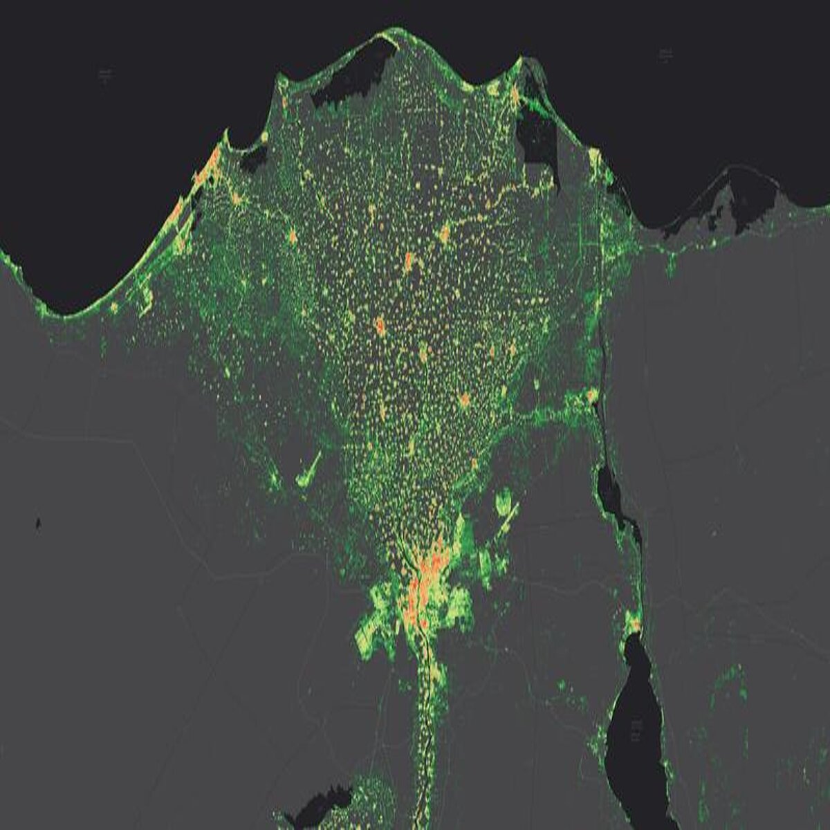
How many buildings are there on Earth – and what do they look like in 3D? The research team led by Prof. Xiaoxiang Zhu, holder of the Chair of Data Science in Earth Observation at TUM, has answered these fundamental questions in this project funded by an ERC Starting Grant. The GlobalBuildingAtlas comprises 2.75 billion building models, covering all structures captured in satellite imagery from the year 2019. This makes it the most comprehensive collection of its kind. For comparison: the largest previous global dataset contained about 1.7 billion buildings. The 3D models with a resolution of 3×3 meters are 30 times finer than data from comparable databases.
In addition, 97 percent (2.68 billion) of the buildings are provided as LoD1 3D models (Level of Detail 1). These are simplified three-dimensional representations that capture the basic shape and height of each building. While less detailed than higher LoD levels, they can be integrated at scale into computational models, forming a precise basis for analyses of urban structures, volume calculations, and infrastructure planning. Unlike previous datasets, GlobalBuildingAtlas includes buildings from regions often missing in global maps – such as Africa, South America, and rural areas.
New perspectives for sustainability and climate research
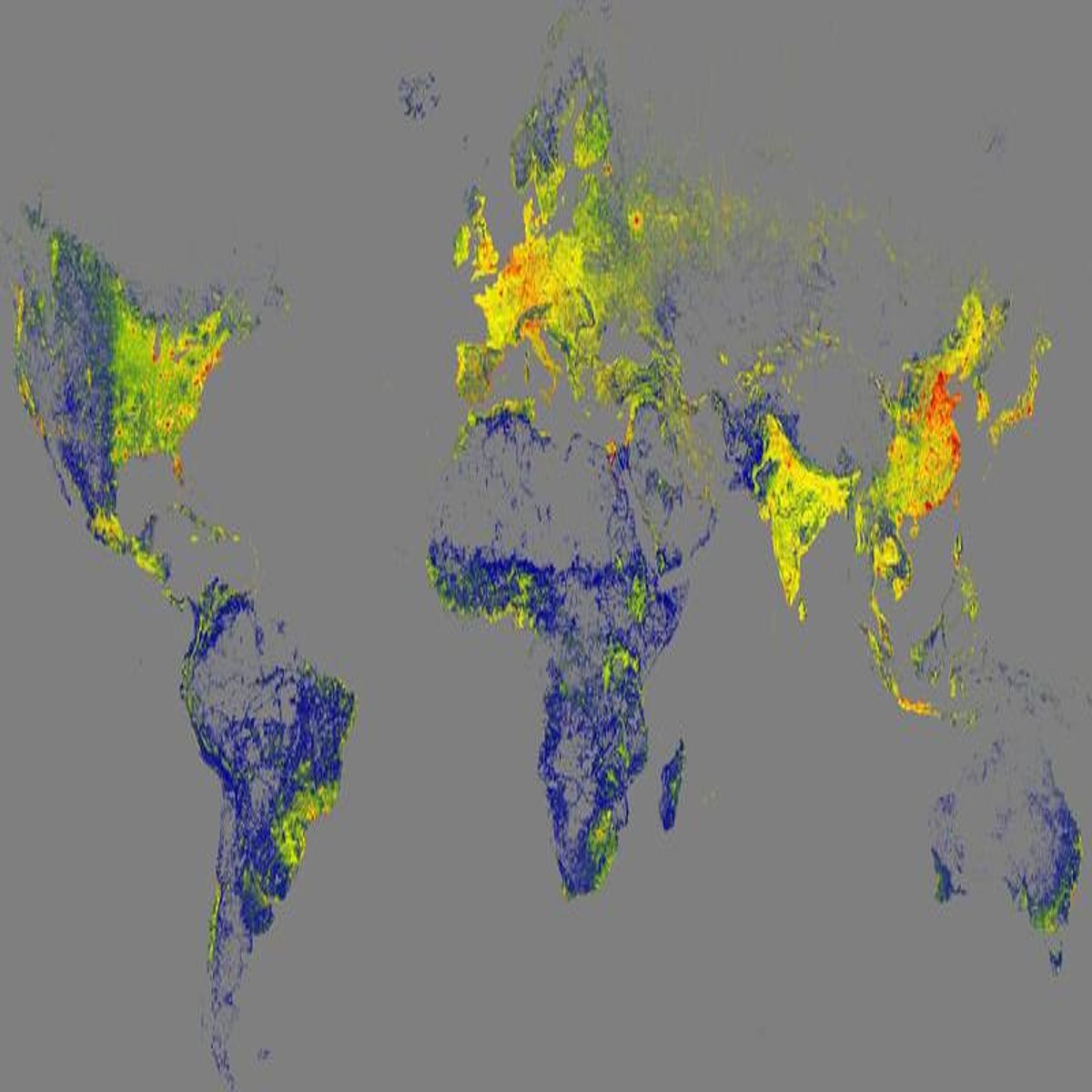
"3D building information provides a much more accurate picture of urbanization and poverty than traditional 2D maps," explains Prof. Zhu. "With 3D models, we see not only the footprint but also the volume of each building, enabling far more precise insights into living conditions. We introduce a new global indicator: building volume per capita, the total building mass relative to population – a measure of housing and infrastructure that reveals social and economic disparities. This indicator supports sustainable urban development and helps cities become more inclusive and resilient."
Open data for global challenges
The 3D building data from the GlobalBuildingAtlas provides a precise basis for planning and monitoring urban development, enabling cities to take targeted measures to create inclusive and equitable living conditions – for example, by planning additional housing or public facilities such as schools and health centers in densely populated, disadvantaged neighborhoods. At the same time, the data is crucial for climate adaptation: it improves models on topics such as energy demand and CO₂ emissions and supports the planning of green infrastructure. Disaster prevention also benefits, as risks from natural events such as floods or earthquakes can be assessed more quickly.
The data is already attracting a great deal of interest: The German Aerospace Center (DLR), for example, is examining the use of the GlobalBuildingAtlas as part of the "International Charter: Space and Major Disasters".
All data and code are freely available via GitHub and mediaTUM, TUM's media and publication server.
https://github.com/zhu-xlab/GlobalBuildingAtlas
https://mediatum.ub.tum.de/1782307
Like the databases and satellite data already available to the public, the project complies with all security standards for satellite data. In accordance with the German Satellite Data Security Regulation, the data is not considered sensitive due to its resolution of over 2.5 meters.
Contact for scientific information:
Prof. Dr. Xiaoxiang Zhu
Technical University of Munich
TUM School of Engineering and Design
Chair of Data Science in Earth Observation
Tel. +49 (89) 289 - 22659
xiaoxiang.zhu@tum.de
https://www.asg.ed.tum.de/sipeo/home/
https://www.ed.tum.de/en/ed/home-1/
Original publication:
Zhu,X. X., Chen, S., Zhang, F., Shi, Y, Wang, Y. „GlobalBuildingAtlas: an open global and complete dataset of building polygons, heights and LoD1 3D models“. Earth System Science Data (ESSD). DOI: 10.5194/essd-17-6647-2025 https://doi.org/10.5194/essd-17-6647-2025